


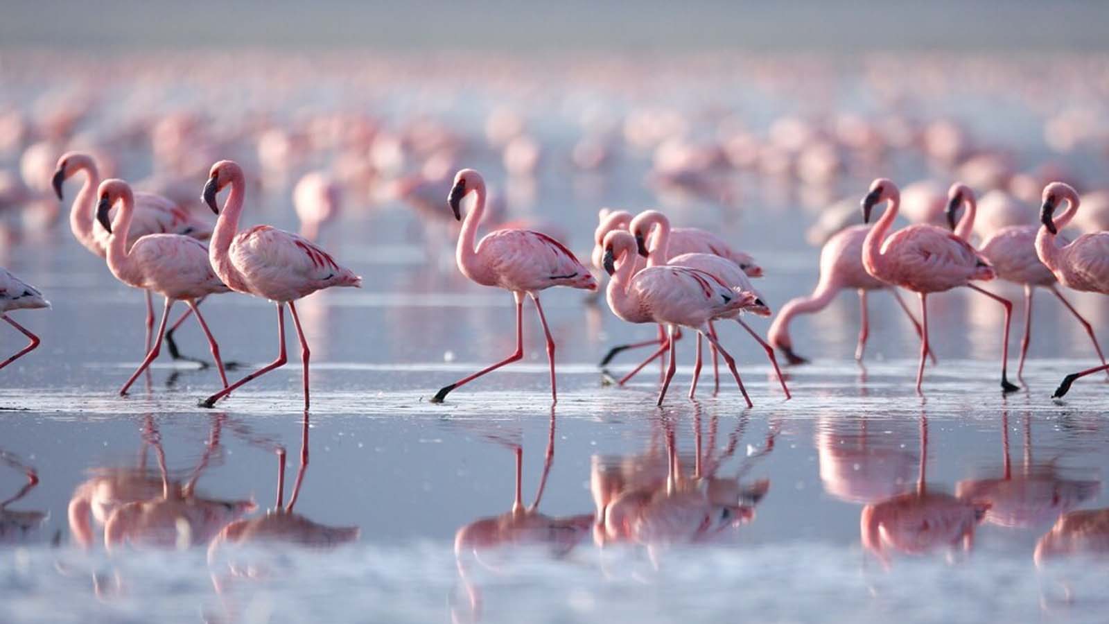
African Safari Tours with Africa Odyssey
We are safari experts, long-established specialists in all aspects of african safari itinerary planning and ground management across sub-Saharan Africa. Therefore, whether you are dreaming of the ultimate walking safari through the heart of Zambia’s South Luangwa National Park or a champagne breakfast in the Masai Mara, whether you wish to encounter wild gorillas or enjoy the ultimate Indian Ocean island beach break, we will design the perfect itinerary for you. Take a look at our ultimate video guide to visiting Africa; the best initial research tool out there.
Africa Odyssey: The Expert Safari Tour Operator
LONG ESTABLISHED EXPERTISE: Africa Odyssey MD, Marc Harris, has been a connoisseur of fine safaris for over twenty years; he is a judge of The Good Safari Guide and former director of the African Travel and Tourism Association. Africa Odyssey continues to be an award-winning company, including the title of The Best Safari, Wildlife and Nature Holiday Company at the British Travel Awards. We are fully bonded with ATOL (5397) and have many hundreds of glowing reviews on Trustpilot.
OVER 20 YEARS’ EXPERIENCE: We have been organising holidays in east and southern Africa for the past two decades. The long-established team at Africa Odyssey provide the best, most reliable and up-to-date safari advice, and invariably our safari holidays exceed the highest of expectations.
IN-DEPTH, FIRST HAND KNOWLEDGE: Each member of our expert Africa team have worked, lived and travelled extensively through their specialist countries, and most of the others as well. We maintain our position at the forefront of safari industry by actively engaging with all of our providers and ground handlers, and ensuring that each and every one of our specialist consultants regularly revisits and refreshes their knowledge to ensure it is up to date.
The Best Safari Parks in Africa
Our Guarantee
Plan Your Safari Holiday With Africa Odyssey
Planning your holiday with us is easy – we will do the work for you! There are various ways to get the ball rolling – ideally, give us a call, and have a quick chat to outline your ideas.
Phone us: Call (0)20 8704 1216 from the UK, or +1 866 356 4691 from the US. Discussing your ideas with one of our consultants is the best way to start shaping your ideal holiday; we can give you rough quotes on the phone, and explain various options without bias.
Email us: outline as much information as you can to info@africaodyssey.com , or fill out our contact form and a dedicated consultant will respond promptly with ideas and suggestions.
Come and see us:Visit us in our London offices, and discuss your options over a great cup of coffee. We have copious maps and photos, and will always take time to talk
The Best Safari Lodges in Africa
Your African Safari Holiday; Where To Go
Which of the many exciting safari countries of Africa should you visit? Where would be best for you? We recommend that you firstly consider the time of year, whether you want adventure or luxury – or both - and what type of holiday you are planning. If you are travelling with children, their ages and interests will play into the decision, as, of course, does budget, how much beach time you might like, and all your other unique tastes and interests. Let us know, and we will help you work it out.
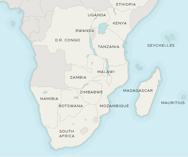
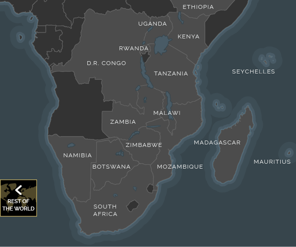
East Africa vs Southern Africa?
At the initial research stage we would suggest you broadly assess whether to head to East Africa, (including Tanzania, Uganda and Rwanda), or Southern Africa, (including Botswana, Namibia, Zambia, Zimbabwe and South Africa). Logistically, East Africa is more economical, with easier and thus cheaper access to the best beaches and islands of the Indian Ocean.
Southern Africa is best for itineraries including CapeTown and/ or Victoria Falls, and can be combined with beach breaks in Mauritius or Mozambique. With most safari holidays we organise you have to fly-in to the camps and lodges, though East Africa offers some opportunities for drive-in itineraries. With regards to safaris, each individual country and park is different, but generally East Africa has classic, sweeping plans and provides old-school style tented safaris, while Southern Africa has more private concessions offering a wide range of safari activities.
Safari and Beach?
For the ultimate safari and beach combination, we would recommend East Africa. The Indian Ocean beaches are accessible, whereas from South Africa they are a lengthy and expensive flight distant, to Mauritius, or Mozambique.
Show me more >
Africa Safari Itineraries
Your African Beach Holiday; Where To Go
The best Africa holidays are not just about safaris; the Indian Ocean coast has some of the most glorious beaches and islands in the world, all within easy striking distance.
From East Africa, (Tanzania, Uganda, Rwanda, Kenya), the easiest beach options are:
From Southern Africa, (Zimbabwe, Zambia, Botswana, Namibia), the easiest beach options are:
Our very own videos
Design your own Africa safari holiday with Odyssey Explorer
We maintain our pages to keep them as informative and current as possible, but it is always worth getting in touch directly, by email or telephone; world travel details constantly change and the excellent deals we get from our suppliers vary from week to week, which means your best source of information and recommendations will always be from our experts.
However, for those looking to do a bit of their own research before getting in touch, we are delighted to launch our new safari planning and costing tool: Odyssey Explorer. This new itinerary planning allows you to work through core itinerary structures, assessing the best lodge for your time and budget.
The app also contains maps, photos and much more information on each and every lodge and area. Of course this is not intended to replace our expert advice, but it is a great tool if you want to do some independent homework on your options, as it cleverly allows for fairly accurate price comparisons.
Our app is still in Beta so please do have a play around with the itineraries and let us know if you like it!
Useful Blogs